1-877-795-2278 | info@aircraftspruce.ca
Aircraft Spruce Canada
Brantford, ON Canada
Corona, CA | Peachtree City, GA
Chicago, IL | Wasilla, AK
Aircraft Spruce Canada
Brantford, ON Canada
Corona, CA | Peachtree City, GA
Chicago, IL | Wasilla, AK
THE AVIATION SUPERSTORE FOR ALL YOUR AIRCRAFT & PILOT NEEDS | 877-795-2278
Aeronav IFR Gulf Of Mexico Central Chart
$25.90/Each
Part# 13-08003
MFR Model# IFRGMC
MFR Model# IFRGMC
- JUMP TO
- Overview
- Reviews
- Q&A
- View in Catalog
Overview
|
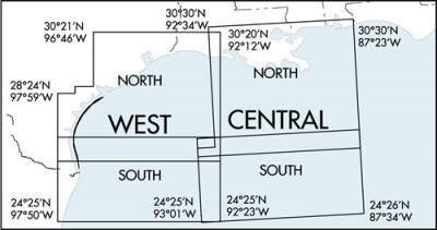
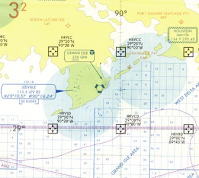
IFR Gulf of Mexico Chart is designed for helicopter operations. These 5-color charts depict an IFR GPS waypoint grid system that aids in the direct routing to oil platforms in the Gulf. NAVAIDs and airport data are shown on this chart along with special use airspace and oil lease block information.
The IFR Gulf of Mexico Central chart depicts the east side of the IFR Gulf of Mexico Vertical Flight Reference Chart with an additional 2½ degrees of coverage on the back. Chart: Scale 1 inch = .86nm/1:500,000; 45 x 36 inches flat or 5 x 9 inches folded. Revised annually. |
Q&A
Please note, Aircraft Spruce Canada's personnel are not certified aircraft mechanics and can only provide general support and ideas, which should not be relied upon or implemented in lieu of consulting an A&P or other qualified technician. Aircraft Spruce Canada assumes no responsibility or liability for any issue or problem which may arise from any repair, modification or other work done from this knowledge base. Any product eligibility information provided here is based on general application guides and we recommend always referring to your specific aircraft parts manual, the parts manufacturer or consulting with a qualified mechanic.

 Aircraft Spruce Canada
